A Quick War Drive
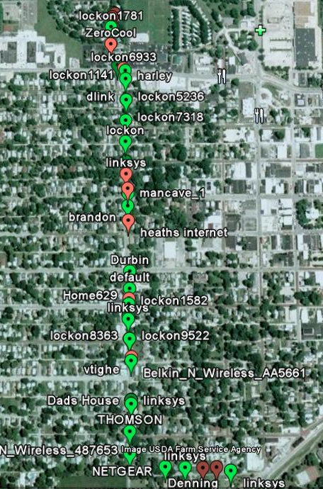
I made a quick little war drive tonight between my Girlfriend’s parents house to our place (only a mile or 2 apart), and I was surprised at the number of Wireless Access Points… not only WAP’s, but completely open and un-secured WAP’s!
Take a look:
All of the Green flags represent completely open WAP’s. The Red ones are using some type of encryption whether it is worthless WEP or one of the nice WPA’s.
I used my HTC Fuze and it’s built in GPS running Wififofum to generate the Google Earth file loaded in to the image above. Pretty neat stuff.
Just an interesting little image I thought I would post. It kind of tempts me to do a more detailed drive of some surrounding blocks, just for the fun of it. Plus there is one network that is just DYING to be cracked… “ZeroCool”… what a tool. I may have to break out my bootable BackTrack USB thumb drive on that one…

KrAzE
I like wififofum. Yea, and if only we could harness that same bandwidth to give us a better more reliable 3g signal out here 🙂